Air masses are bodies of air with different properties. They form over different areas causing them to be Warm, Cold, Moist, and Dry. Depending on where they formed determines what type of air mass is created.
Continental (C)
This air mass forms over a continent. Since there is little water on land compared to the oceans they are typically dry air masses.
Maritime (M)
This airmass forms over water. Since there is plenty of water here the airmass is typically moist.
Polar (P)
This airmass forms in the northern or southern hemisphere above 50 degrees latitude. They are cold airmasses.
Tropical (T)
This airmass forms in the lower latitudes and are warm airmasses.
Continental Polar (CP)
This airmass is dry and cold. It forms over land and over the cooler latitudes of the earth.
Continental Tropical (CT)
This airmass is dry and warm. It forms over land and over the warmer latitudes of the earth.
Maritime Polar (MP)
This airmass is moist and cold. It forms over water and over the cooler latitudes of the earth.
Maritime Tropical (MT)
This airmass is moist and warm. It forms over water and over the warmer latitudes of the earth.
When air is warm the molecules are farther apart allowing for more water holding ability. This also causes the air to be less dense.
When air is cold the molecules are closer together allowing for less water holding ability. This also causes the air to be less dense.
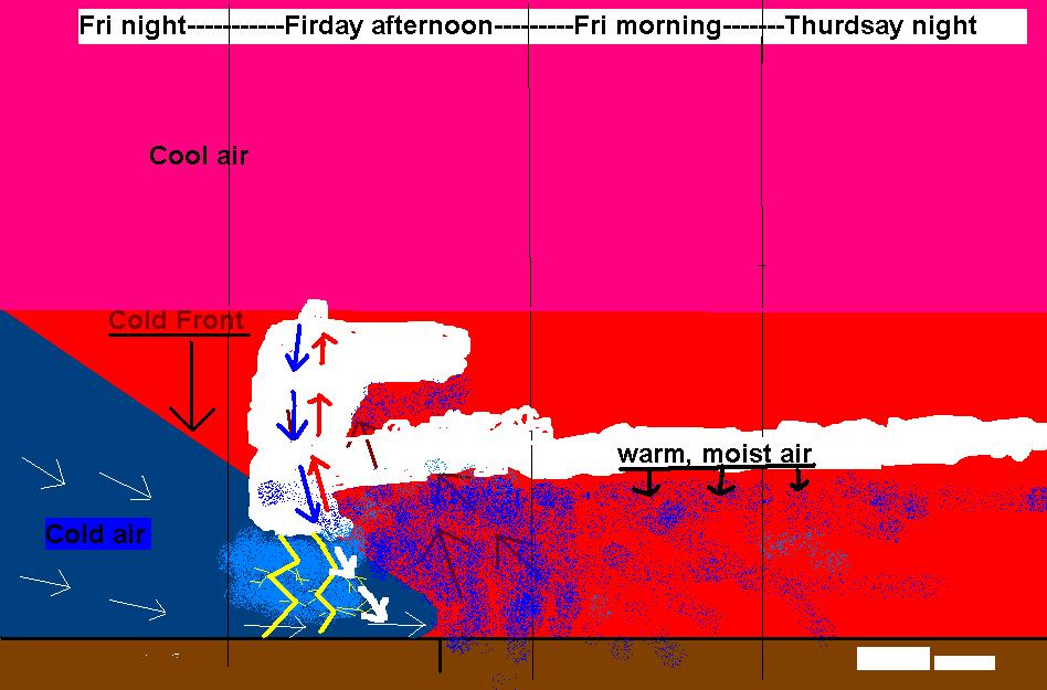
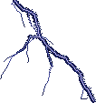
Airmasses which are more dense tend to sink close to the ground and if they come into contact with less dense airmasses they push them up and away from the earth. This interaction of two different airmasses is what is called a FRONT.
When a cooler airmass is moving and pushing a warmer airmass up and away from the earth you get a cold front. The movement of the warmer air up and away from the earth causes it to cool and condense resulting in precipitation.
the diagram to the right shows a cold front
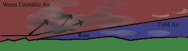
WARM FRONT
When a warmer airmass is taking the place of a coler airmass. As the warm air pushes up and against the cooler airmass the warm air rides up and over the cooler air causing long periods of precipitation and clouds.
The Diagram to the right shows a warm front. As you can see the warm air is riding up and over the cooler air due to differences in density. Based on the image can you tell which is less dense?
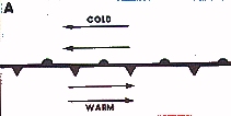
STATIONARY FRONT
When two different airmasses are in contact with each other but neither are moving you get a Stationary Front. Storms often use this as a "road" and move up the boundary from high to low pressure causing periods of precipitation.
The diagram to the right shows a Sationary Front
Two airmasses are moving in opposite directions
neither airmass is advancing over the other. What front would you get if the cold air moved into the warm air?
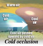
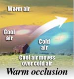
OCCLUDED FRONT
This very complex front is fromed when a cold front catches upto a warm front. The resulting lift causes heavy precipitation. There are two types of Occluded fronts. Cold air and Warm air Occlutions. See the images below to see what this means
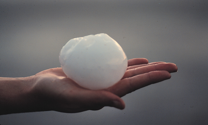
Snow is formed when the air is cold enough for ice crystals to form and grow in the clouds. When they get heavy enough they fall as snow. If the air is not below freezing during the snow flake's trip to the ground it can melt and turn into rain. Click the image to learn more.
Sleet
Sleet is formed when precipitation forms and falls as snow from the clouds. This frozen precipitation enters a layer of warm air and melts into liquid (rain). It then enters a layer of cold air and freezes into ice pellets prior to hitting the ground.
To learn more please click the image to the right.
http://www.usatoday.com/weather/wgraph0.htm
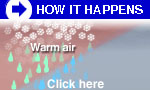
Freezing Rain
As you learned above sleet is when liquid precipitation freezes before hitting the ground. If there is a very shallow layer of cold air in place and liquid precipitation falls through this layer and does not freeze before hitting the ground only to freeze upon contact you get freexing rain . The image to the right explains more.